Environmental Justice and Neighborhood Schools in Chicago
Report links Heading link
Introduction Heading link
The Illinois Environmental Justice Act (415 ILCS 155/1) aims to “ensure that communities are not disproportionately impacted by degradation of the environment or receive a less than equitable share of environmental protection and benefits.”
Environmental justice is based on the principle that all people should be protected from environmental pollution and have the right to a clean and healthy environment. Environmental justice is the protection of the health of the people of Illinois and its environment, equity in the administration of the State’s environmental programs, and the provision of adequate opportunities for meaningful involvement of all people with respect to the development, implementation, and enforcement of environmental laws, regulations, and policies.
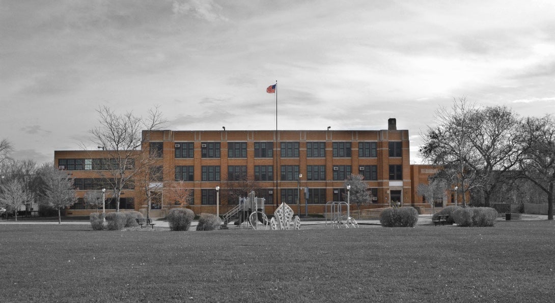
A prerequisite for validating a state of environmental justice in a community is identifying disparities in the distribution of environmental benefits and burdens. In a previous study involving Chicago neighborhoods, the distribution of environmental hazards were documented, focusing on the southwest area of the city.1 In this study, a different approach is adopted. The emphasis is placed on a sensitive and relatively immobile population living in these communities: kindergarten (age 5 to 6) to 8th-grade school children (K – 8).
In recognition of their condition, a 1997 executive order (13045) states that each federal agency:
- Shall make it a high priority to identify and assess environmental health risks and safety risks that may disproportionately affect children;
- Shall ensure that its policies, programs, activities, and standards address disproportionate risks to children that result from environmental health risks or safety risks.
The Chicago Public School (CPS) district administration implicitly recognizes the importance of equity2:
Equity is more than a series of stand-alone initiatives: it is the driving core value which informs every decision we make, from capital improvements to curriculum design.
Introduction text, continued Heading link
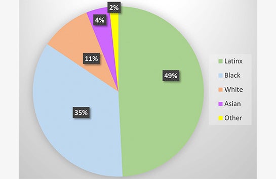
For the current study, to avoid residency issues, students in neighborhood public schools were only included since most of these children are likely to reside in the local communities. Based on the information from the CPS district data portal, the K-8 student population for the 2016-2017 school year was 181,357, concentrated in 328 schools. The adjacent figure depicts the racial composition of this population; as seen, almost half of the student body is Latinx. Poverty is another dominant characteristic, with 79.1 percent of these students living in below-poverty level households.
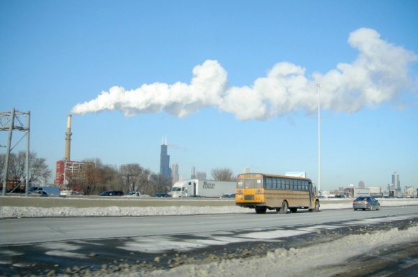
The emissions from Toxic Release Inventory (TRI) facilities in their communities are the major environmental hazards these children are exposed to. Under the environmental equity principle, the proximity of schools to TRI facilities should be randomly distributed regardless of location and the community’s socioeconomic position characteristics. A total lack of disparities (i.e., random distribution) is an unlikely status due to the asynchronous development of industrial zones, urban development, and school districts. For this reason, it is important to quantify the state of disparities and identify the overburdened areas. This information is vital for prioritizing amelioration and re-zoning programs within the city (such as Greening of Industry initiatives which is “a method to attain sustainable economic growth and promote sustainable economies. It includes policymaking, improved industrial production processes, and resource-efficient productivity”)3. In addition, these overburdened areas with their sensitive population qualify to become the prime site locations for air quality monitoring networks by state or city environmental quality agencies.
The primary goal of this report is to provide the means to visualize the level of disparities in the City of Chicago regarding the proximity to TRI reporting facilities to schools. In this context, the term “disparities” refers to the hypothesis that school children do not share equally (proportionally) the hazards posed by the TRI facilities. Spatial hazard distribution disparities do not necessarily imply an elevated health risk due to exposure; however, they signify a structural inequity that cannot be ignored.
Data sources and limitations Heading link
Data sources and limitations, continued Heading link
- Preparation and preliminary analysis was performed with the IBM® SPSS® Modeller 18.2.1.
- Geospatial data integration, mapping, and spatial analysis were performed using ESRI’s ArcGIS Pro.
- The socioeconomic data used to study the characteristics of the study area were obtain from the U.S. Census Bureau American Community Survey; 2018 release of 5-year estimates.
The TRI site has a section on the “Important Considerations for Using TRI Data” that lists the characteristics and limitations of this database.
A limitation for this and similar spatial proximity studies is that environmental quality monitoring data are not available to explore associations with health outcomes. For this reason, surrogates of hazard exposure are used, the most common being proximity measures.4 As stated in our objectives section above, this report does not aim to identify health outcomes related to potential exposures. At this stage of the study, the dashboards can be used as a tool for prioritizing re-zoning strategies, implementing industrial greening initiatives and identifying air quality monitoring sites that will yield reliable data for health outcome studies.
Data availability dictates the time frame of this study (2017). Given the assumption that the societal distribution of the burden of environmental hazards is not a status that evolves rapidly in time, this selected time frame is timely. For practical and communication purposes, the selected spatial scale of analysis for this dashboard is the recognizable Chicago community area level. The potential for scale effects cannot be ignored and is a topic that is further explored in a forthcoming publication.
Explore the data analysis Heading link

Conclusion Heading link
The main purpose of this paper is to introduce this dashboard as a tool for identifying disparities. From this preliminary stage of the study, the following conclusion is drawn: TRI reporting facilities in the Chicago area are likely to be concentrated near neighborhood public schools in communities which have a predominantly Latinx student population. The unequal distribution of the TRI school burden underlines the need to:
- Re-examine the industrial zones of Chicago and establish a carrying capacity limit by, for example, considering the areas with an elevated burden due to the proximity of their schools to TRI reporting facilities.
- Establish air quality monitoring networks in the problematic locations identified by this study. This recommendation becomes even more expedient if the other hazard sources are accounted for (such as industrial diesel truck traffic, non-TRI reporting facilities such as asphalt plants, etc.).
About the authors Heading link
Greg Arling, PhD, is a professor of nursing at Purdue University.
Michael D. Cailas, PhD, is an associate professor of environmental and occupational health sciences at the UIC School of Public Health. He directs SPH’s Public Health Geographic Information Systems online certificate program, and his research focuses on water quality monitoring network design, environmental data analysis, risk assessment and cost benefit analysis.
Joel Flax-Hatch is a research assistant and MS in Environmental and Occupational Health Sciences student at the UIC School of Public Health.
Fabio Miranda, PhD, is an assistant professor of computer science at the UIC College of Engineering.
Kristin Osiecki, PhD in Environmental and Occupational Health Sciences ’13, MS in Environmental and Occupational Health Sciences ’11, is an assistant professor at the University of Minnesota Rochester and an adjunct instructor of health policy and administration at the UIC School of Public Health.
Apostolis Sambanis, PhD in Environmental and Occupational Health Sciences ’16, MS in Environmental and Occupational Health Sciences ’12, is the director of curriculum with SPH’s Emergency Management and Resilience Planning certificate program.
References Heading link
- J. Flax-Hatch, A. Sambanis, K. Osiecki, P. Geraci and M. D. Cailas. Identifying Environmental Hazards within Southwest Chicago. UIC-SPH and SEA story map. Original publication date: 20 March 2020. Based on the results presented at the Community Meeting at National Latino Education Institute 01/16/2020.
- Chicago Public Schools (CPS). Equity at CPS.
- United Nations Industrial Development Organization (UNIDO), Green Industry initiative.
- J. Maantay. (2002). Mapping Environmental Injustices: Pitfalls and Potential of Geographic Information Systems in Assessing Environmental Health and Equity. Environmental health perspectives. 110 Suppl 2. 161-71. 10.1289/ehp.02110s2161.